Map of India
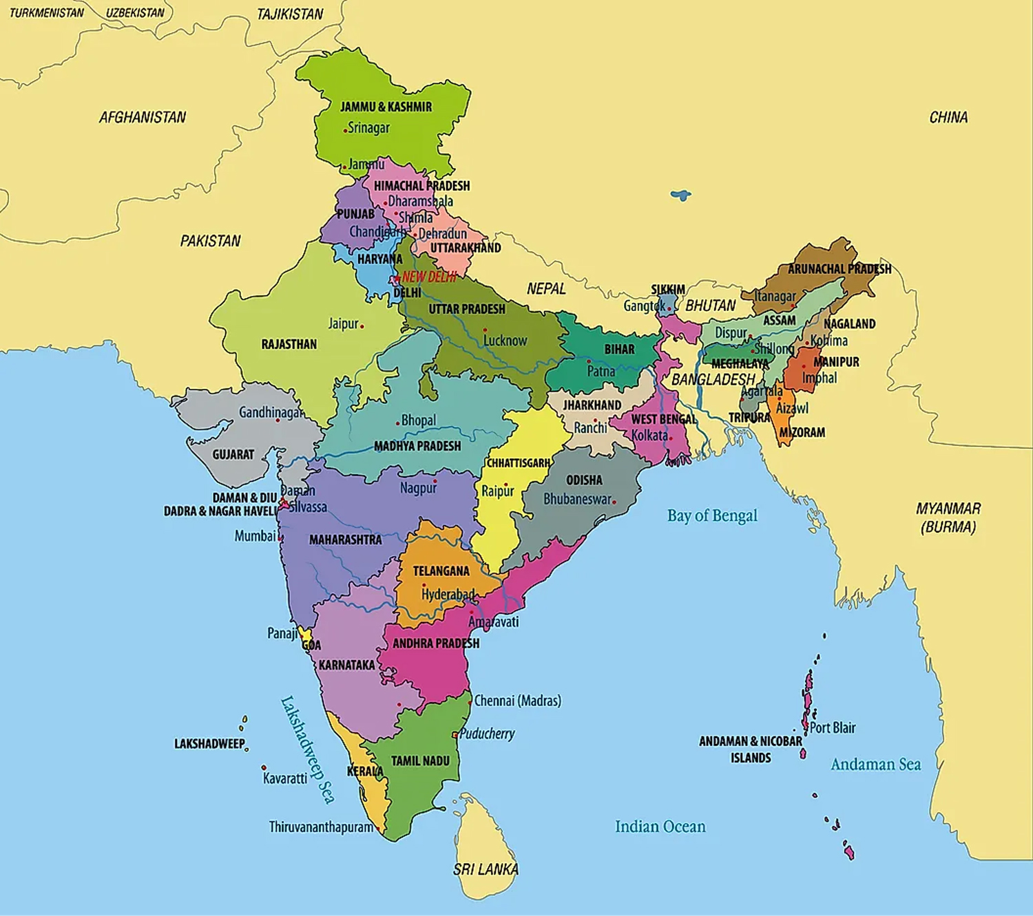
States of India Map
India is divided into 28 states and eight union territories. The states are Andhra Pradesh, Arunachal Pradesh, Assam, Bihar, Chhattisgarh, Goa, Gujarat, Haryana, Himachal Pradesh, Jharkhand, Karnataka, Kerala, Madhya Pradesh, Maharashtra, Manipur, Meghalaya, Mizoram, Nagaland, Odisha, Punjab, Rajasthan, Sikkim, Tamil Nadu, Telangana, Tripura, Uttar Pradesh, Uttarakhand, and West Bengal. The union territories are Andaman and Nicobar Islands, Chandigarh, Dadra, and Nagar Haveli; Daman and Diu, National Capital Territory of Delhi, Jammu, and Kashmir, Ladakh, Lakshadweep, and Puducherry.
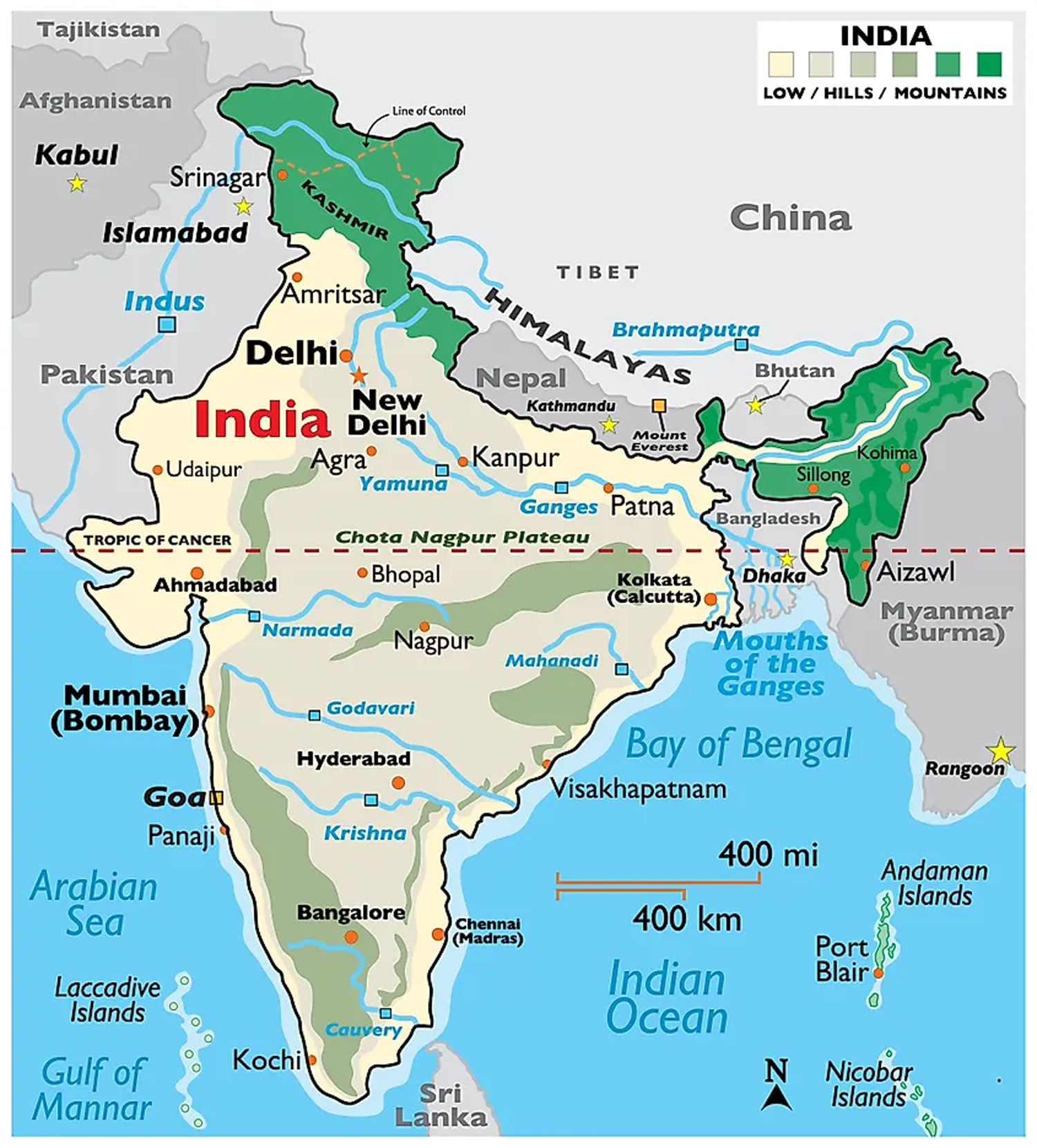
With a total area of 3,287,263 square kilometers, India is the seventh-largest country in the world and the second most populous. Located in the north-central part of the country in the National Capital Territory of Delhi is New Delhi, the capital of India. Located on the west coast of the country is Mumbai, the largest and most populous city in India. It is also the main port of the country, as well as the industrial and commercial center.
Where is India?
India is a large country located on the Indian subcontinent in south-central Asia. India is geographically positioned in the northern and eastern hemispheres of the Earth. It borders Afghanistan and Pakistan in the northwest; China, Nepal, and Bhutan in the north; and Bangladesh and Burma (Myanmar) in the east. It borders the Arabian Sea to the southwest; the Bay of Bengal in the southeast; and the Indian Ocean to the south. The narrow channel of the Palk Strait and the Gulf of Mannar separates the island nation of Sri Lanka from the Indian mainland.
India Bordering Countries: China, Nepal, Bangladesh, Bhutan, Myanmar, Pakistan.